

Winter might sound like an unusual time to start exploring the great outdoors around Mulhouse. It’s cold, the weather is often unreliable and the best views may be spoiled by a lack of leaves on trees or a drab colour palette. Well, none of that stopped me from spending a few weekends in January trying out some of the hiking trails around Mulhouse.
Mulhouse is actually perfectly situated for outdoor enthusiasts. It is a short journey away from Les Vosges, a mountain range that runs down the western side of Alsace. At the time of the Franco-Prussian War in 1870, the Vosges actually marked the French border with Germany. Mulhouse is closest to the part of the mountain range known as the Higher Vosges (Hautes Vosges), perhaps confusingly found at the southern end. In this area, the rounded summits of the mountains are known as ballons (meaning balloons in French). This is what gives the highest mountain in the Vosges, Le Grand Ballon, its name. It stands at just over 1430 metres high, making it not just the highest mountain in the Vosges but also the highest point in the Grand Est region of France.
While some of the hikes in the Vosges are only really accessible if you have a car, such as the Grand Ballon, others are very easy to get to by public transport. This is lucky for me as that’s the only way I get around! I’m hoping that at one point I’ll be able to make it out to the Grand Ballon but for now I’m satisfying myself with hikes such as the two below.
La Cascade de Bubalafels
Starting with the easier of the two hikes I’ve done recently, we have La Cascade de Bubalafels. When my friend suggested this one, I thought he was having me on because surely that name can’t be real! It very much is and it brings me so much joy whenever I see it because it’s so strange but fun! The couple of friends that I went on the hike with are both very interested in linguistics so we did try and find out where the word comes from but couldn’t get any information on it’s roots.
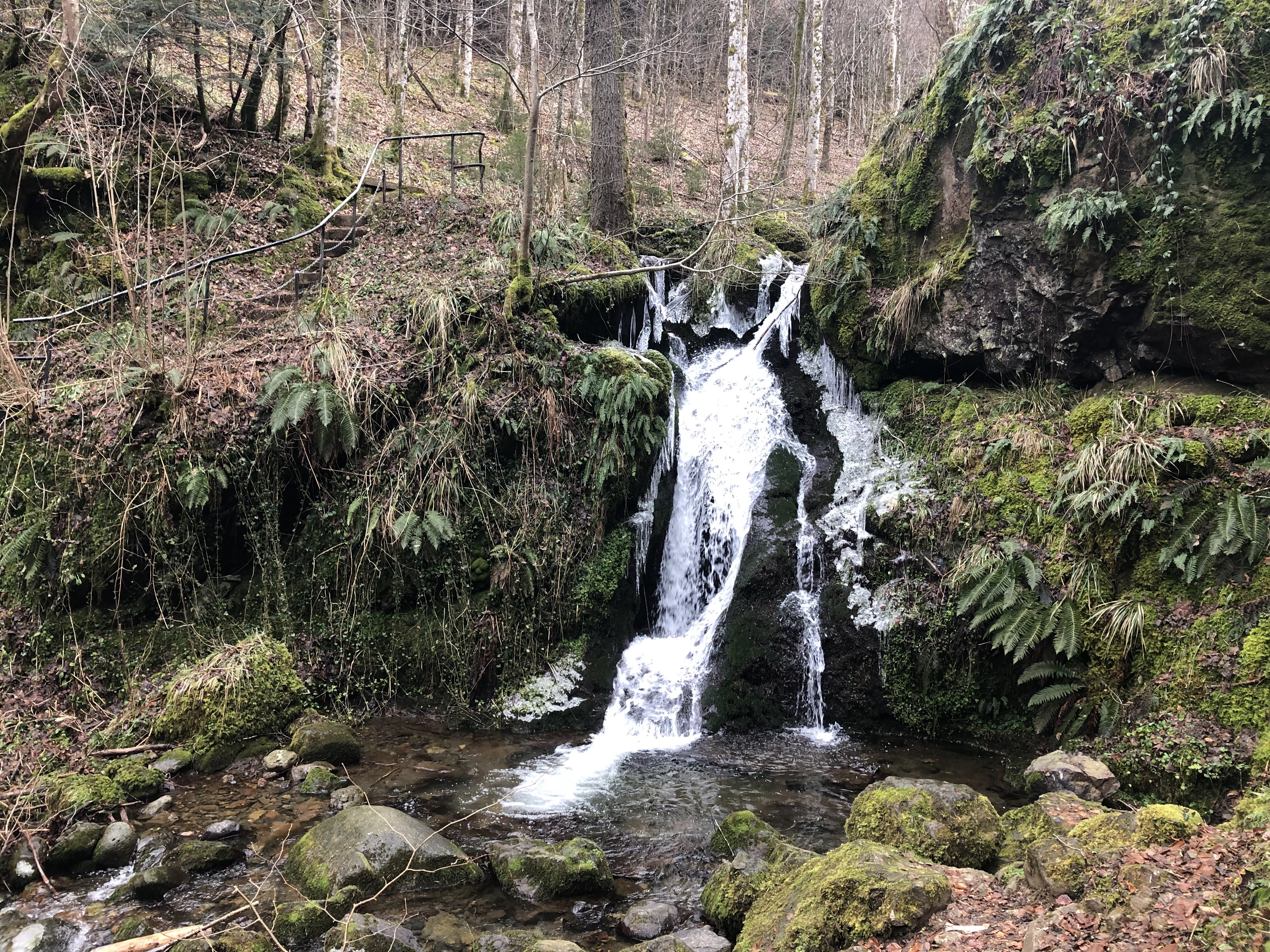
Anyway, La Cascade de Bubalafel is a small waterfall in the foothills of the Vosges, just outside the town of Moosch (pronounced Mosh, like mosh pit). Getting to Moosch from Mulhouse was very easy. You take the tram-train from the city centre (or right outside my flat) towards Thann. You have to change trains at the end of the line at Thann-Saint-Jacques station but there are only two platforms so it’s hard to get it wrong. From there it is a handful more stops until you arrive in Moosch. In total it took just over an hour and costs €3-5 if you have certain discount cards or €7 if not.
It’s a sleepy little town that was almost deserted as we walked through it late on a Saturday morning. A path out of town takes you past a few campsites and into the forest where signs start to appear for Bubalafels. Less than a kilometre down the track and you will come to the waterfall itself. In researching for this blog I did actually find more information about the origin of the name Bubalafels. Apparently it means ‘the rock of the babies’ (I still don’t know in what language) and the whole site of the waterfall has a fertility legend attached to it. According to legend, couples would go to the waterfall and hit a rock overlooking the top of the falls with a hazelnut stick. If the baby was ready it would appear and the couple would take it back to the village.
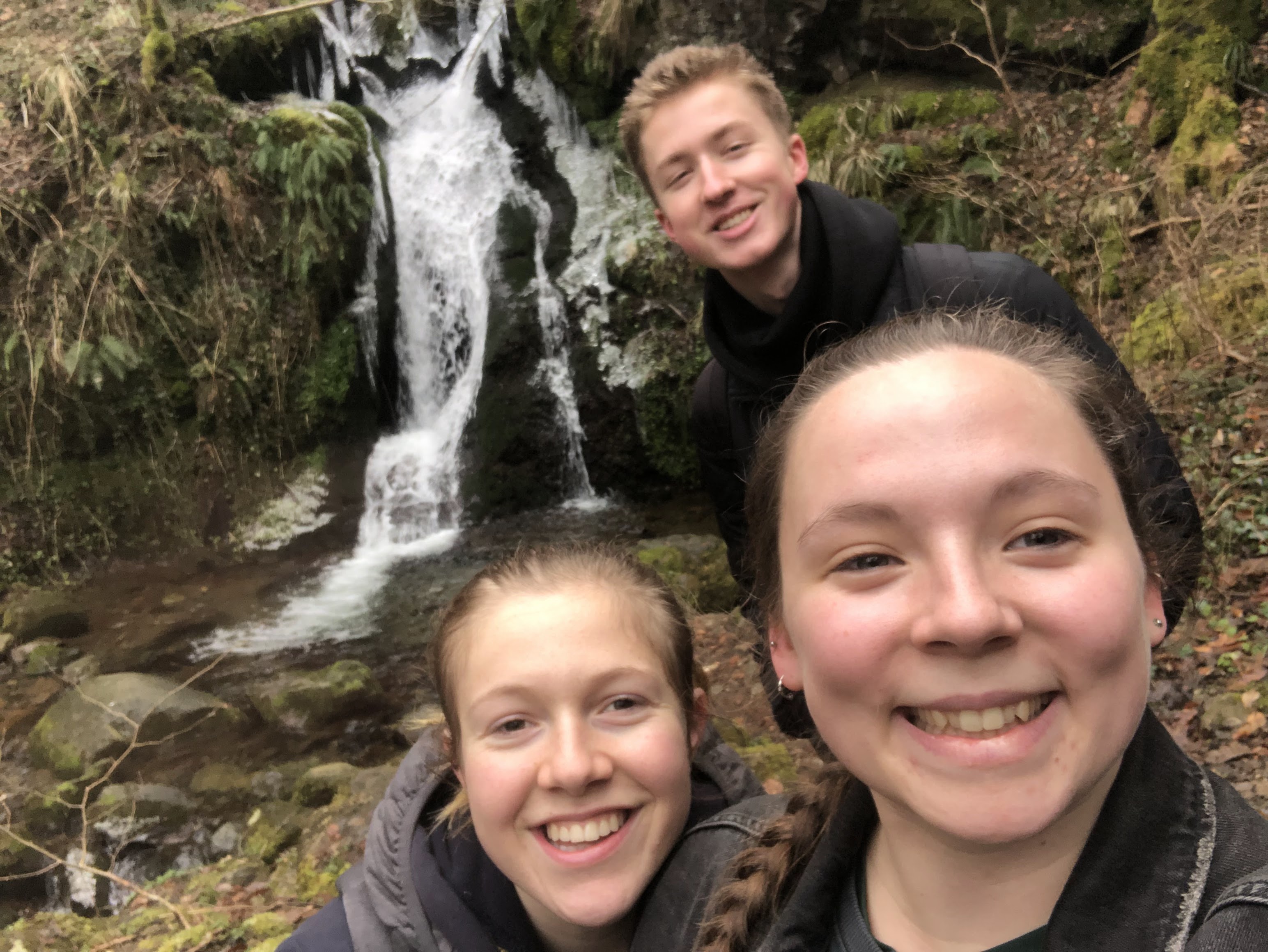
The waterfall itself was very small but it was in a very nice area. There was a viewpoint at the top, a small wooden balcony and just beyond a wide open space surrounded by the forest that is known as the prairie aux abeilles (bee meadow). It is filled with lots of pollen and nectar rich plants which attract a lot of insects. Just beyond the meadow is another point of interest, le sapin pectine. It’s a 46m high, 100 year old tree. It used to have two trunks and was known as the twin tree but one of the trunks snapped in a storm in 1999.

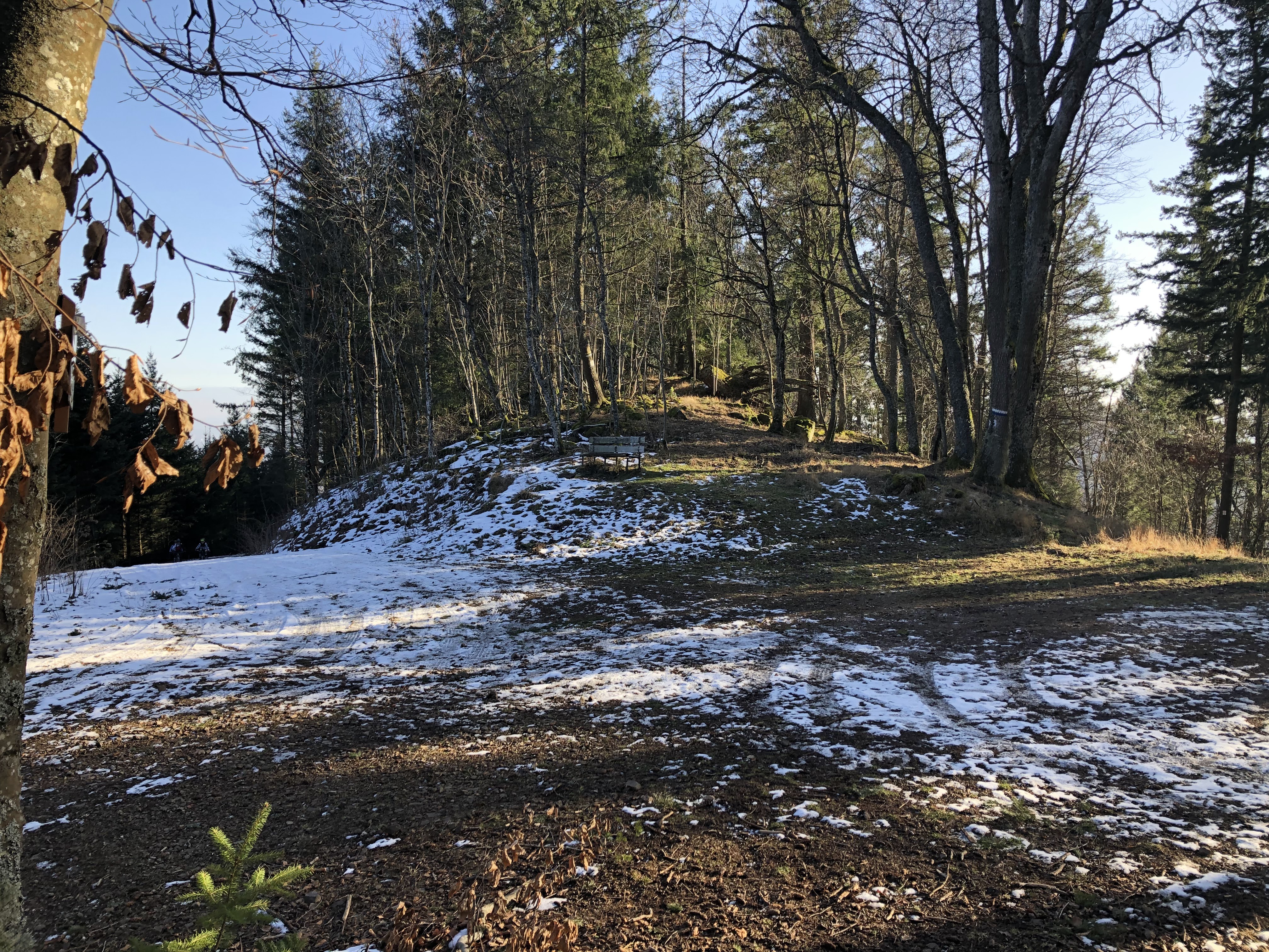
Seeing as the hike to the waterfall was actually pretty short, we decided to keep going up the mountain a bit more. It got a bit steeper than it had been up until that point and we also reached the snow! We carried on until we caught sight of what we think was a hunting party and decided it would probably be smart to head back down the mountain. We stopped at the waterfall again to eat our packed lunches on the wee wooden balcony. It was a very cold day so by the time we’d been out for a few hours, we were cold enough to start heading home.

Overall this was a perfect, easy day hike to do from Mulhouse. It was quite laid back with the option to go further if you wanted to, surrounded by the tranquility of nature. The one critique I would have was that the village of Moosch, our start and end point, was very quiet. It could have something to do with the fact it was a Saturday afternoon (apparently that means nothing will be open) but we couldn’t find anywhere to have a cup of tea to warm up while we waited for our train. Instead we had to sit in the drafty shelter on the platform for 45 minutes… All in all though, a good beginners hike that isn’t too much of a hassle to get to if, like me, you rely on public transport.
Pastetenplatz
Another hike that I’ve done recently started in the village of Thann and involved walking up to a point on the mountain next to it called Pastetenplatz. I would say that this hike was a little more challenging than the previous one, particularly the first twenty minutes, but it’s still very manageable for the casual hiker.
The village of Thann (pronounced like tan) sits at the bottom of the Vosges and has the river Thur running through it. To get to Thann from Mulhouse is pretty much the same as it is to get to Moosch, detailed above, but shorter. You can get the tram-train from any of the stops in Mulhouse and get off at Thann Centre around 50 minutes later, for between €1.70 and €5.

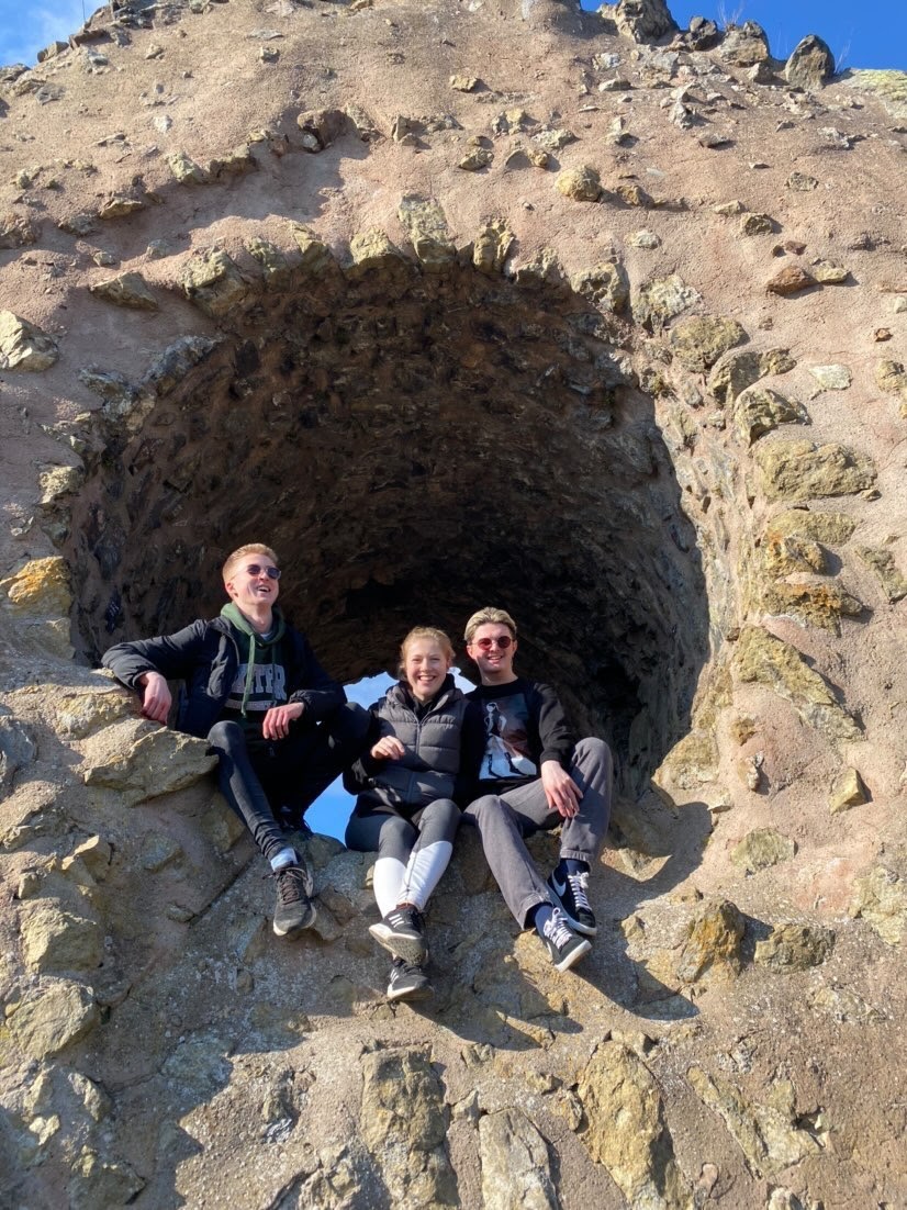
One of the main attractions in Thann are the ruins of Château de l’Engelbourg (the Engelbourg castle) and l’Œil de la Sorcière (the Witch’s Eye) which sit on a small hill overlooking the town. The castle was built in the 13th century by Count Frederic II of Ferrette in order to control the Thur valley. It was a private residence at times as well as a garrison at others. It was badly damaged during the Thirty Years War in the 17th century and the main tower toppled, creating what is now known as the Witch’s Eye, surveying the village below.
There are signs through the centre of Thann that will lead you towards l’Œil. The path up the hill to the ruins is very steep which I was not prepared for! It’s very intense but only takes about twenty minutes to get up to the ruins. It was helped that we were accompanied by a cat that had started following us on the main road and followed us at least half of the way up. The view from the hilltop was incredible. There is a great panoramic aerial view down into the town that lets you see all the beautiful buildings in Thann as well as some neighbouring vineyards, some of the other mountains in the Vosges and across the Upper Rhine Plain. You can climb up into l’Œil but I didn’t fancy the scramble so was designated photographer for my friends who did make the climb.

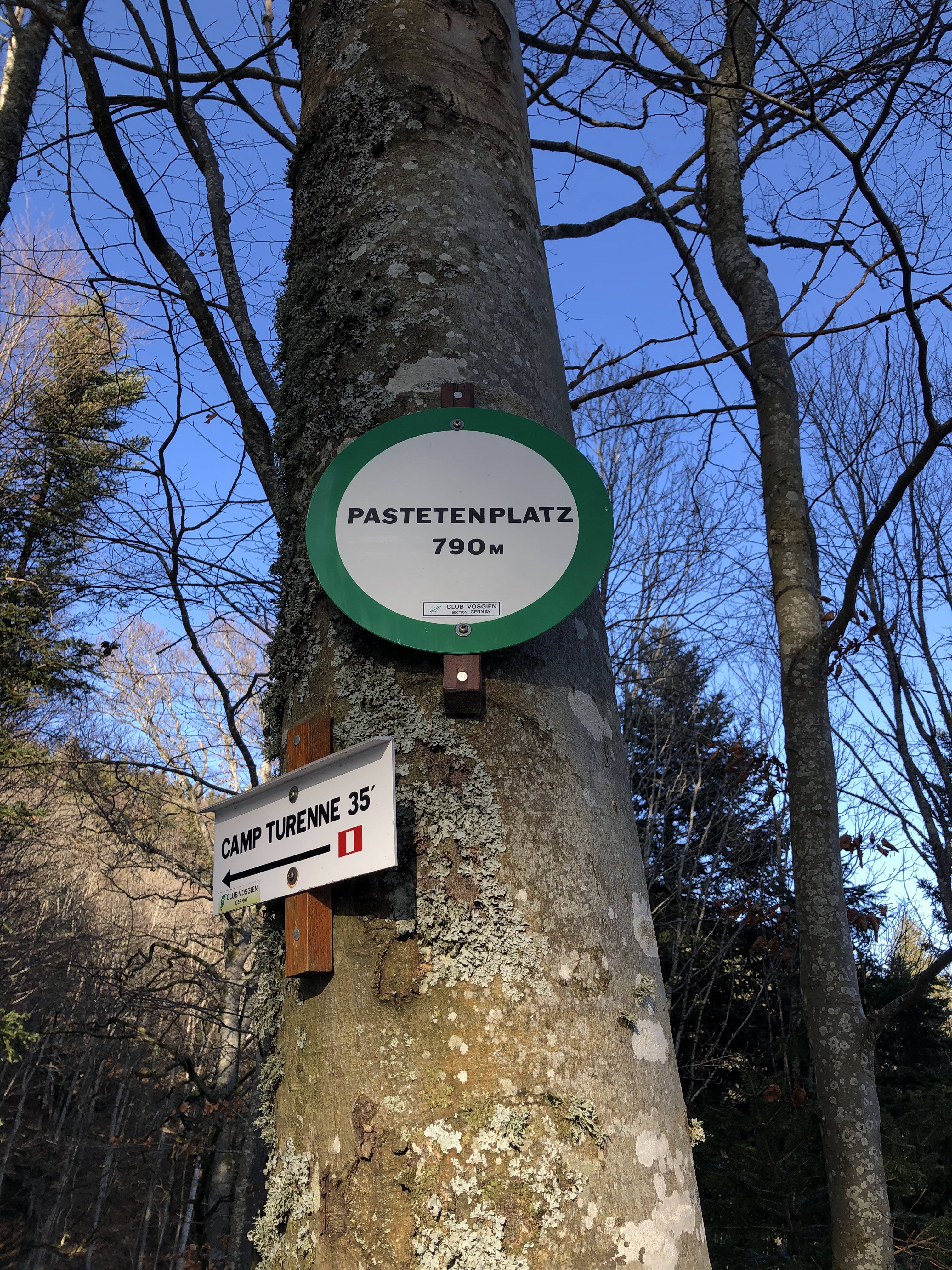
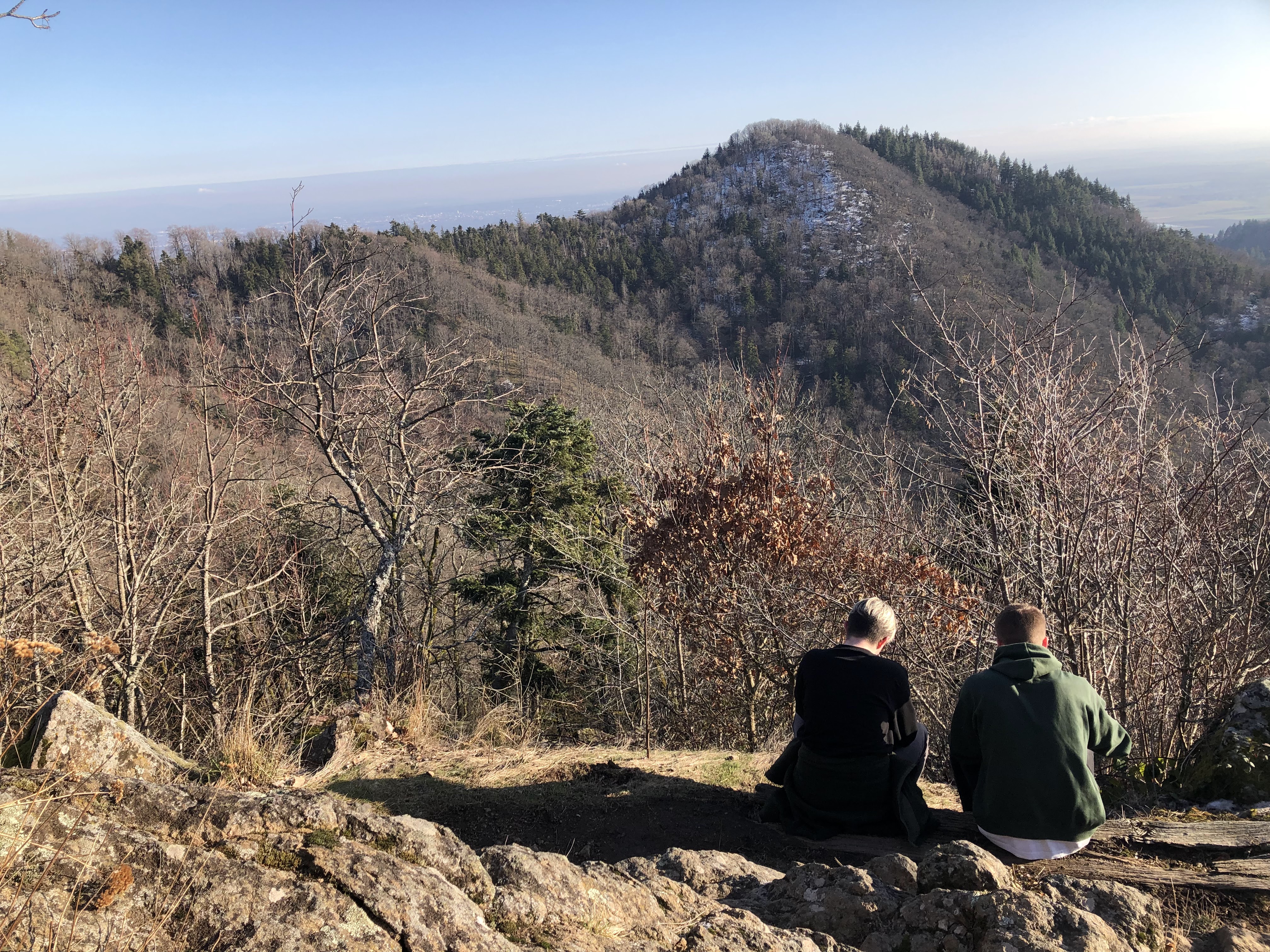
From the ruins of the Château de l’Engelbourg you can continue up the mountain. Thankfully it’s not as steep as that first twenty minutes up to the ruins. There are steep moments but also flat parts when you wind around the side of the mountain or more gentle inclines. I have to admit that when we arrived at Pastetenplatz, I was a bit disappointed. We had very arbitrarily chosen Pastetenplatz as our goal and turn around point and it turned out to be just a clearing in the forest. However, going back down the path a little there is a small shelter next to an outcropping of rocks and a wotan oak tree. This was the real reward for making it up the mountain as far as we did. We could see back down to Thann, now just a speck in the distance, and we could actually see over as far as Mulhouse. We figured out that it was Mulhouse because you could see the recognisable silhouette of the Eurotower, one of the buildings in the city centre.

Heading back down towards Thann was much easier than the way up. Overall it took us about four hours to go from the centre of Thann, up to the ruins and Pastetenplatz and then back down. We finished with a cold beer in a small restaurant called Au Petit Rangen in Thann, the perfect way to end a day of hard work!

