As a Brit, hiking is certainly not the first thing that comes to mind when I think about Tenerife. It’s definitely known more for resort holidays and Brits abroad. While this type of holiday or tourist dominates the south of the island, it is still possible to find pockets of hiking. Elsewhere on the island you are much more likely to find people that have come to Tenerife for outdoor adventures. For example, 3 million people visit the volcano each year. The north of the island is also a hotspot for hiking because of the Anaga rural park. This part of the island is particularly popular among Germans, to the point that you will find a lot of the signs in Anaga in Spanish, English and German. While hiking isn’t the top of my list of activities, I did a fair bit while I was in Tenerife and enjoyed it a lot! I’m here to share some of my wisdom, both from personal experience and from what I picked up while working in the hostel. For example, I didn’t climb Mount Teide in my time on the island but I gathered lots of information from the people that did.
Mount Teide

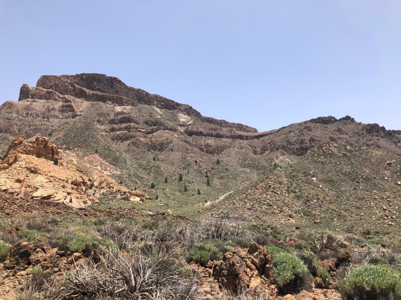
Mount Teide is the dormant volcano at the centre of the island of Tenerife. It is the highest point in Spain and also the highest point in the islands of the Atlantic. It has been a UNESCO World Heritage Site since 2007. It is the most visited natural attraction in all of Spain as well as the most visited national park in Spain and Europe and the eighth most visited in the world! It’s a popular place! Because of that there are certain restrictions around climbing to the peak that I’ll get into. There are also some controversial plans to restrict entry to the national park as a whole. The aim is to improve conservation by restricting cars and instead implementing guided tours by bus, similar to the situation in Timanfaya national park in Lanzarote. However, there is some resistance which I think is very valid, especially when it comes to restricting access for Canarians as well as just tourists.
The main Mount Teide hike via Montaña Blanca is just under 9km long and takes most people 5-6 hours. It has some very steep stretches but the main difficulty comes from the altitude change, starting from 1,367m and finishing at 3,718m. There are a couple of different options when it comes to climbing Mount Teide.

By day:
- Mount Teide is in a national park and for conservation reasons the number of people allowed to summit per day is limited to 200. Because of this you need a permit to reach the very top between the hours of 9am and 5pm. It is free to reserve but needs to be applied for 2-3 months in advance as slots fill up fast.
- You can still climb Teide without a permit but will have to stop 200m from the peak. There are a lot of hiking trails around here so if you want to hike the volcano but don’t have the permit it can still be worthwhile, as long as you don’t mind missing out on the last little bit!
- Climbing by day in the summer can be very hot and the sun is very intense without many areas of shade during the ascent.
By night:
- Because of the permit needed to summit during the day, many people choose to climb Teide by night. Starting around 2am will get you to the summit for around 7am in time to watch the sunrise over the clouds, an incredible experience.
- Compared to hiking during the day, it gets very cold on the volcano at night. You will need lots of layers and a head torch to light your way.
- You must have left the summit by around 8am to start your descent. This is when you will get to actually enjoy the views now that there’s daylight to see them!
- Some people stay at Hotel Parador near the start of the trail so that they are nearby for starting to climb in the middle of the night. There is also the option of staying the night at the Refugio Altavista at an altitude of 3260m. You climb to this point the day before (the refuge opens at 5pm) and then set out for the summit in the morning. It takes less than two hours to reach the top from the refuge. Note that there is a kitchen but you must bring your own food and there are toilets but no showers.

Teide also has a cable car that will take you up to less than 200m below the peak. It starts from La Caldera de las Cañadas (the crater surrounding Teide) at 2356m. There is always the option of climbing up and taking the cable car down or vice versa, or taking it both ways if you want to maximise your time on the island. It takes 15 minutes and costs €38 for a return ticket. A few things to note when it comes to the cable car. If the wind is too strong, they will close the cable car. I have also heard of some people having more difficulty with the altitude when taking the cable car. Issues with altitude are something to be cautious about in general as it can make the climb more challenging than it would be otherwise but there is less time to acclimatise when taking the cable car.
A few notable attractions on Teide are its shadow and the observatory. The shadow that Teide casts on the sea is the largest of its kind in the world. It is projected more than 40km from the summit, reaching all the way to the islands of La Gomera in the morning and Gran Canaria in the evening. Because of Teide’s height and position above the clouds most days, it is also the perfect place to have an observatory. Teide is a great place in general for stargazing.
Montaña Guajara
Next up is an alternative to hiking Teide itself. Montaña Guajara is a much smaller mountain on the other side of La Caldera de las Cañadas that looks over to the volcano. It has some of the best panoramic views in all of the Teide national park, in my humble opinion. If Teide seems a bit intimidating, as it did to me, if you don’t have the time or if you have any other hesitation about hiking Teide, Montaña Guajara is a great option. Some of the other volunteers and I were looking for a hike to do near Teide and this was recommended to us by our all knowing receptionist Karen.
The full Montaña Guajara trail is a roughly 10km loop and takes 5-6 hours to complete. The hike is rated as medium difficulty but has some very steep sections and is generally covered in scree so can be a bit slippy. I wouldn’t say you need any fancy shoes though, even specific hiking shoes. I just had trainers and one of my friends did this hike in a pair of chunky Filas (not your average hiking shoes for anyone that doesn’t know). Montaña Guajara is a peak of 2,718m but the ascent starts from 2,100m at the Cañada Blanca visitor centre. There is very little chance for shade on your way up so take a hat, sunglasses and lots of suncream. Don’t forget to reapply! Also take more water than you think you’ll need, generally a good strategy for hiking in hot weather. There is a small cafe at the visitor centre but we brought our own picnic lunch of sandwiches and salad to keep us going.

On the practical side of things, the easiest way to access this hike is if you have your own car. Drive up to the Cañada Blanca visitor centre and there is a car park there. This is also the place to head if you want to go to the Roques de Garcia, another popular area to hike around but not one I’ve been to. But fear not! If you have no car this is still very doable as I was in this situation. Coming from the south of the island, bus 342 leaves from Costa Adeje bus station at 9.15am and will take you up to the Teide national park. There is only one of these buses a day so be there a little early to make sure you get a seat. It will take about 1h40 to get to El Parador where you should get off, right by the Cañada Blanca visitor centre. There is also only one return bus that will reach El Parador around 15.40, giving you about three and a half hours to enjoy the hike. Unfortunately this isn’t long enough to complete the whole loop but we worked our way up, taking lots of breaks and stopping to eat and enjoy the view. We still made it to the ridge below the peak itself before we had to head back down and the views are unparalleled. It’s hard to imagine that they could get much better from further up.
I would recommend heading into the visitor centre before getting started. They are able to tell you exactly which trails you need to follow to get to Montaña Guajara. There are lots of routes that start from this same area so better to ask and be sure that you don’t start off on the wrong one. From what I remember (but take this with a pinch of salt), to go anti-clockwise round the loop you start on trail #4 (Siete Cañadas), join #31 briefly and then #5 will take you to the top. If you do want to carry on down the other side, follow #15. During the climb you will be able to see over to Teide in all her glory. Those with eagle eyes can spot the cable car, as well as the Roques de García below and the lava field at Boca Tauce off to the side. Depending on the weather you might also see the ‘sea of clouds’, when the cloud line sits at 1600m which is well below the altitude of Montaña Guajara.
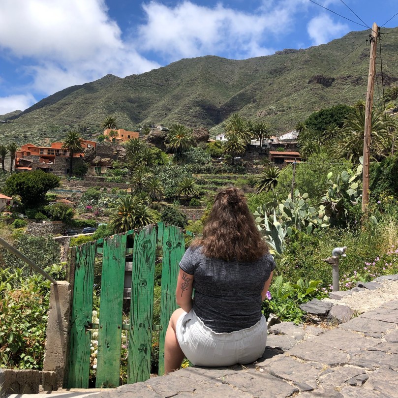
Masca

Possibly the most famous hike on the island other than Teide, the Barranco de Masca hike is another one that I have not personally done but gathered plenty of information on during my time on Tenerife. Masca is a hamlet with a current population of 90 nestled in the Teno hills on the north west coast of Tenerife. The town is a popular attraction in its own right and somewhere I visited more than once for its incredible scenery. It is known as the ‘lost’ or ‘forgotten’ village by some which you will understand when you see how well it has assimilated into the hillside. It is accessible by car down the treacherously steep and winding road down from Santiago del Teide or from Garachico in the north via Los Silos. Favoured by bus tours, it is best to visit the town earlier in the morning or late in the afternoon.
Masca’s main attraction is the Barranco de Masca (Masca Gorge). The gorge is 5km long and descends to the ocean and then returns back to the town, a hike of 10km in total. In total it should take no more than 7 hours although it is possible in less. Previously you could hike down the trail to Masca beach and take a ferry to Los Gigantes, past the cliffs of the same name. I think this would be so cool and you would get the best of both worlds, the downhill part of the Masca hike and then the chance to see the incredible Los Gigantes cliffs from a new angle. Unfortunately this is no longer possible as the Masca jetty is currently closed to the public. It has been this way since the start of the pandemic but there is hope that it will be open in the near future!
If you want to hike the gorge, you will need to book a slot. Currently the barranco is only open on Saturdays, Sundays and bank holidays, from 8.30am to 11am March-Oct and 8.30am to 10.30am Oct-March. The trail closes at 6pm all year so you must have returned to the start point by this time. Because of the limited opening times, spaces book up well in advance. The trail can also be closed due to adverse weather in which case you can change the date of your reservation or get a refund. You will need to arrive 30 minutes before your reserved slot and have a piece of ID with you.
The hike has a fairly high difficulty with rocky ground and slippery sections along the narrow path which means there are certain restrictions for hikers before you are allowed to enter. You must wear closed toe hiking boots with ankle support and deep lugs, indentations that improve grip. If you arrive wearing normal trainers or open toed shoes you will be denied access to the trail. You will also be given a helmet by trail staff. Currently it is free to hike the Masca trail but soon tickets will be €8 for residents of Tenerife and €16 for visitors. The money will go to conservation and safety of the gorge.
Barranco del Infierno

Last but not least, we have Barranco del Infierno. Just as Montaña Guajara is a good alternative to hiking Teide, this is a great and much less popular alternative to Masca. Barranco del Infierno means Hell’s Gorge and is located in the town of Adeje in the south of Tenerife. Adeje is an interesting town to visit because other than the barranco, there are no other tourist attractions so it’s filled with locals. If you want a slice of every day Tenerife, Adeje can give you some insight.
The total route there and back is about 6.5km with minimal ascent or descent. It takes about 2.5 hours to complete at a very leisurely pace or as little as 1 hour if you really pace it. Like Masca, you must reserve a slot in advance. However, because it is a less popular trail it is possible to do this the day before or even the day of. You can enter the trail between 8.30am and 11.30am and it closes at 2.30pm at which time you must have exited the trail. Barranco del Infierno is also a protected area so tickets cost €11 for visitors and €4.50 for residents.

Because the level of difficulty is low for this hike, you don’t need to have proper walking boots. Trainers are fine but they cannot be open-toed. You will also be given a helmet to wear. The hike ends at a waterfall but don’t hold your breath. It isn’t anything too impressive, especially in summer when it is rather dry. The real views are as you make your way down the gorge. A top insider tip, end your hike like I did at the Restaurante Otelo right next to the starting point. Try the chicken or the rabbit for some typical Canarian food!
Bonus – Anaga Rural Park

Anaga Rural Park makes up the most north eastern part of the island, what could be described as the panhandle if looking at Tenerife on a map. It is also the oldest part of the island, having been created 8 million years ago from a volcanic eruption. It is full of craggy peaks and deep valleys covered in lush green vegetation. This will really show you the stark differences between the north and the south. In the north you need jumpers and a rain jacket while the south is shorts and flip flops!
Because Anaga is the furthest point on the island from where I was staying down in Costa Adeje (still only an hour by car but closer to three by bus) I only got to visit once. It was combined with a visit to a nearby beach so I didn’t have a lot of time to spend there. Because of this I sought out a pretty short hike just to get a feel for Anaga. I was recommended to head to Cruz del Carmen which is a viewpoint with some trails around it. On a clear day you can see all the way to Teide as well as the towns of La Vega Lagunera and La Laguna. This is a good place to visit in general, not just for the views but also because there is a visitor centre where you can get a lot of information on the park.

There is a trail loop that leaves from Cruz del Carmen called El Sendero de los Sentidos (the Trail of the Senses). There are a few options of different lengths and difficulties but I decided to do the longest one because it was still only supposed to take an hour. I say supposed to because, even with a group of six people, we could not figure out the right route to take. We ended up doing the same section two or three times thinking we were missing a turn to get on to the rest of the trail but that turned out to be all there was and it was just shorter than we expected! If you don’t have a lot of time to do one of the longer hikes in the park, this is a good option so that you can still get a taste for it.

While I was in Anaga I also visited the viewpoint of Pico del Inglés that has a view across the capital of Santa Cruz de Tenerife, the mountains of Anaga and Mount Teide. Unfortunately, the clouds and rain had closed in the day I was there so you could not see very much at all! We also ventured down from the mountains to the northern coast with the aim of reaching Playa Benijo, supposedly one of the most beautiful beaches on the island. However, I was the one driving and being on the right hand side was difficult enough but then the road got a little too narrow and challenging for my liking! Instead we stopped by Playa Almaciga and ate in Casa Pepe where I had the best octopus I’ve ever had in my life. I still think about it to this day…
Anaga Rural Park covers 140km² so there is plenty more to discover. The town of Taganana, on the road down to Benijo, has preserved its traditional Canarian culture better than many towns on the island and is also home to Las Vueltas de Taganana, a hiking loop of moderate difficulty that takes just under 4 hours to complete. There is also a hiking loop that will take you from the hamlet of Taborno to Roque de Taborno, known as ‘Tenerife’s Matterhorn’, which takes about 2 hours. There is El Pijaral, Tenerife’s Enchanted Forest (Bosque Encantado), a laurisilva or laurel forest in the south of Anaga. It is a protected area so you will need a permit to enter and while it is free, only 45 people are allowed to enter each day so spaces fill up fast.
Hopefully this has shown you a new side to Tenerife and given you itchy feet to get out there and go hiking! As I’ve said, some of these hikes I have already done but the rest are still on my to do list!